Short crossing
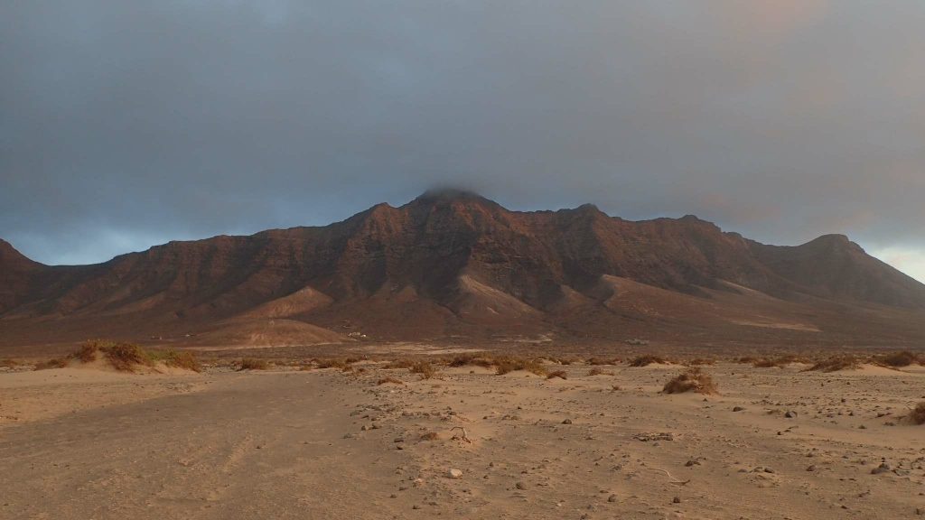
Delayed by few days, we finally left Agadir. It is on a superb 54 feet that we will spend this short crossing (about 260 nautical miles). Offshore, the wind is between 18 and 20 knots, it will blow 20 knots during the night. The autopilot is set, we will not touch the sails of the ride! Night shifts are difficult but not undoable. When sleep is around the corner, just take your head out for 10 minutes! Lanzarote appeared on the horizon from 2pm.
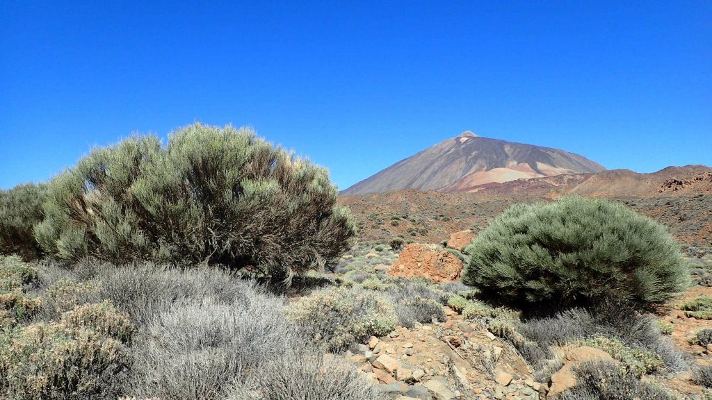
As soon as I arrived on the island, a small mount seems calling me. Neither one nor two, I put on the hiking shoes on and set out to discover this summit. The wait in Agadir was a bit long, I have to get back to the sport!
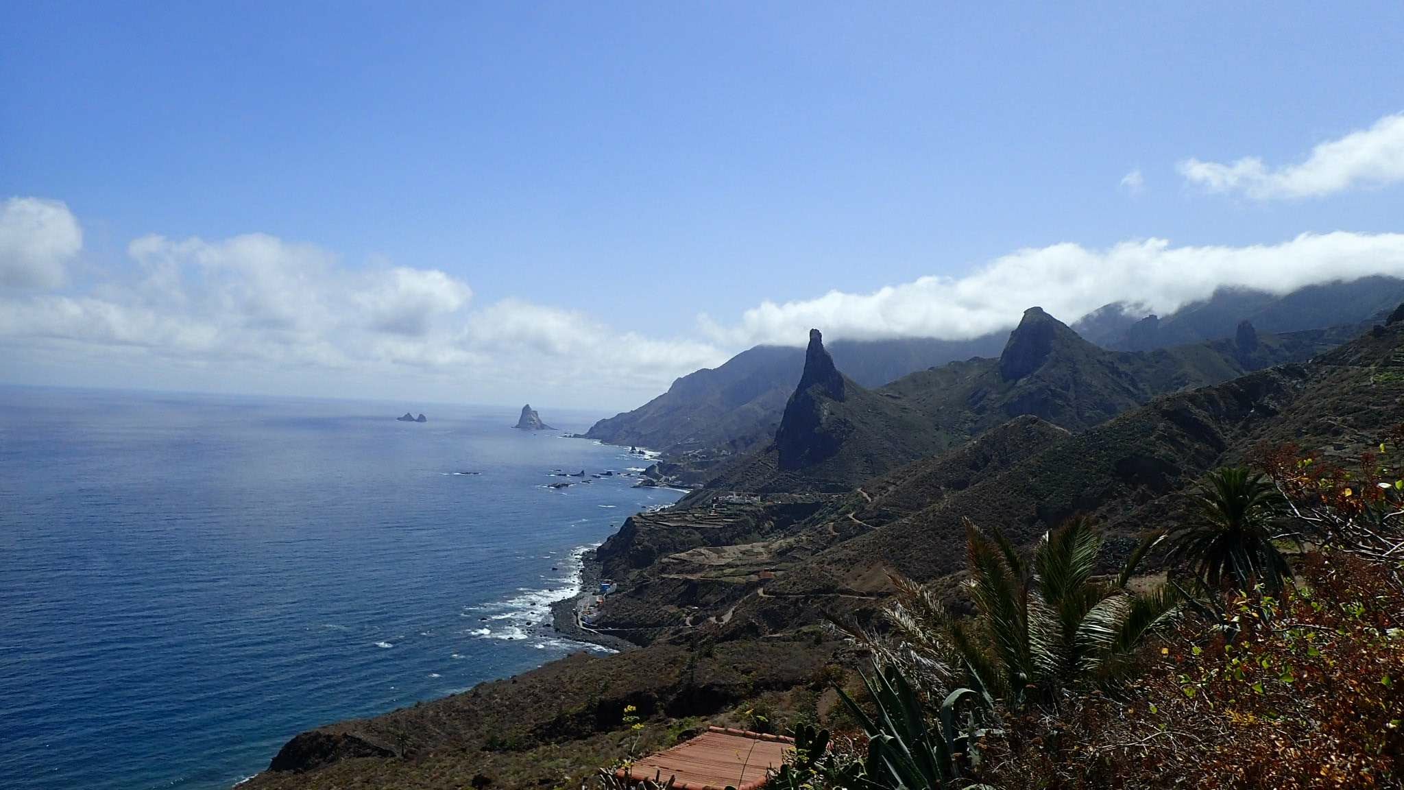
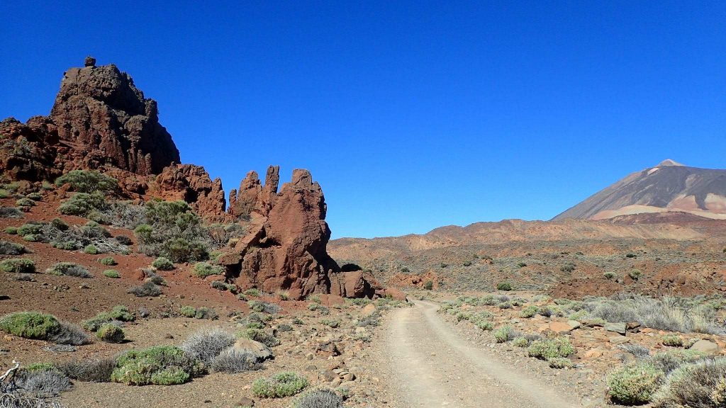
Isla Negra and Isla playa (Lanzarote and Fuerteventura)
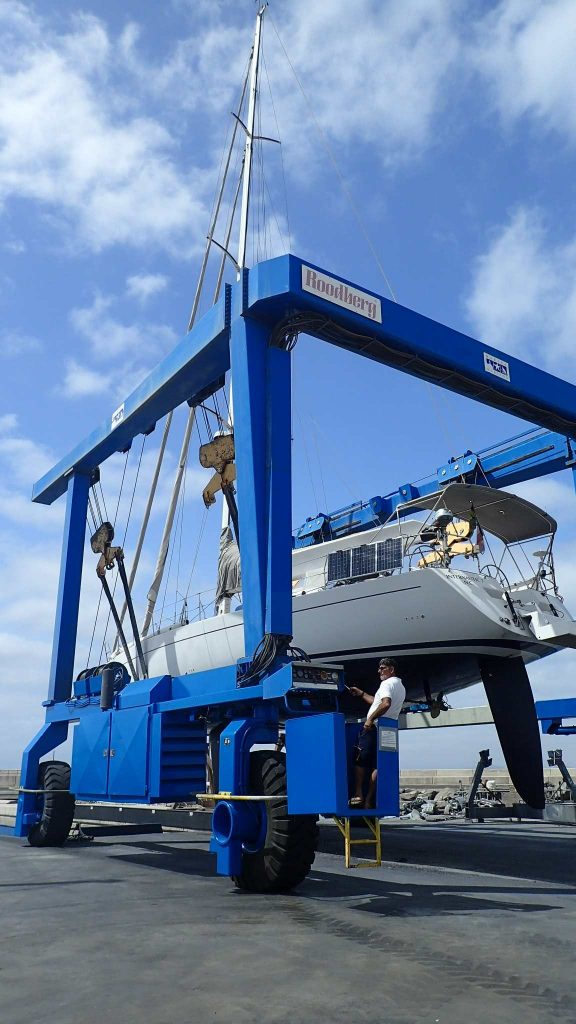
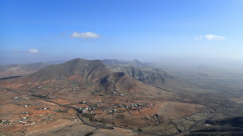
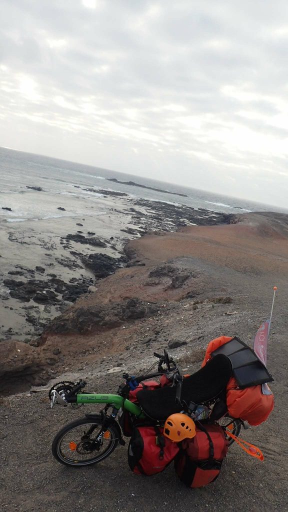
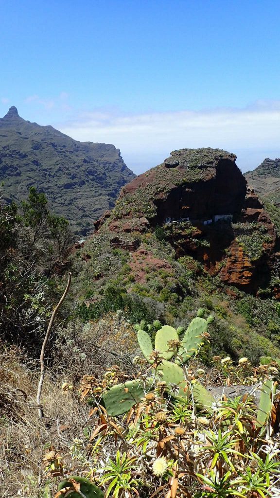
Lanzarote offers mountainous lunar landscapes. As Thierry needs a little help to get the boat out of the water on Wednesday, I have at least two days to cycle around the island. It is about 60km long. A Warmshowers can host me Monday night on Arrecife, that’s good!
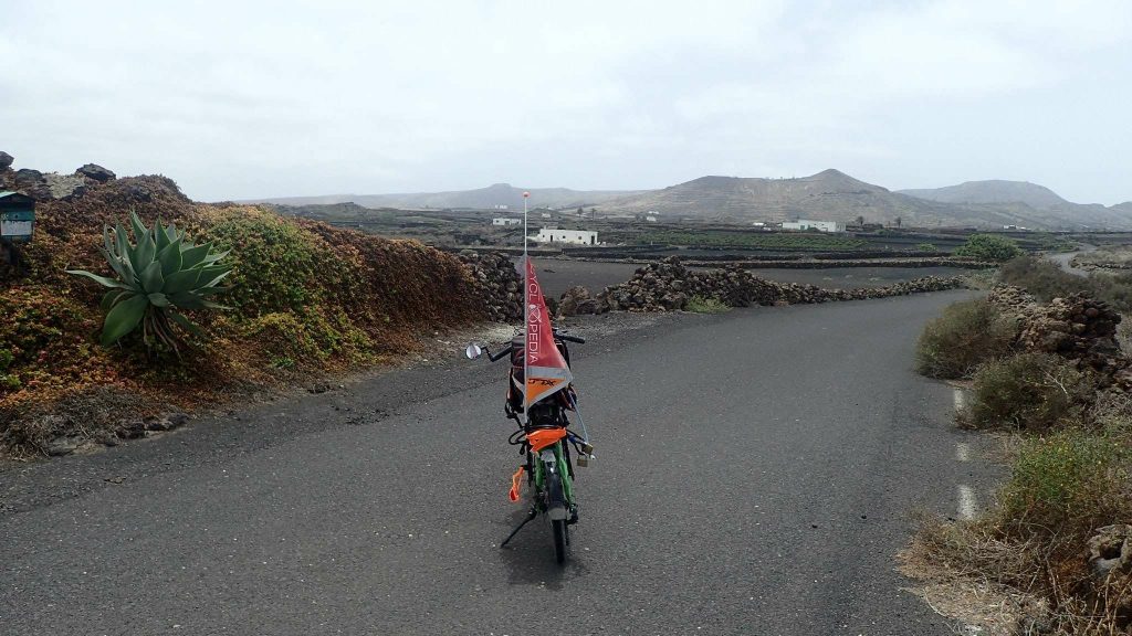
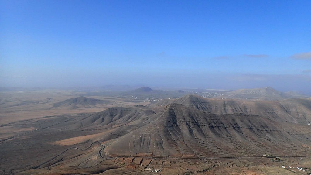
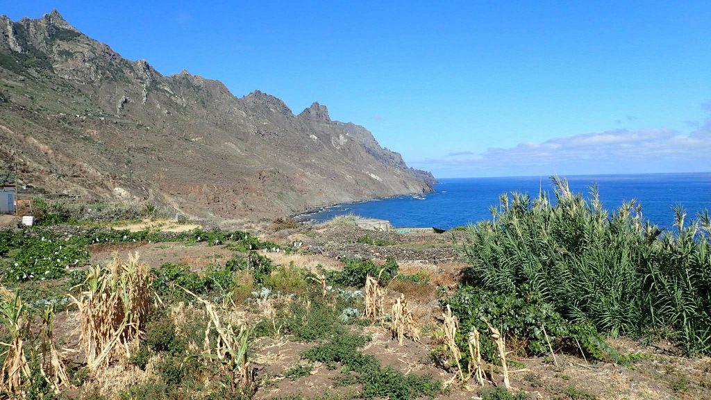
Despite the desert climate, there is some agriculture on the island. Reputedly windy, the vines grow at the bottom of small “craters”, which gives the fields a special charm. Tourism (and probably EU/Spain) helps, road infrastructure is fairly new, and “old” national roads are reserved for cyclists. Lanzarote is by far the most cyclo-friendly island! Dacio, who hosted me in Arrecife, even tells me that many professional cyclists come to train here. And for good reason: the climate is mild all year round, there is good infrastructure and many climbs! Above all, the natural wind tunnel of the island allows you to train in unfavorable conditions!
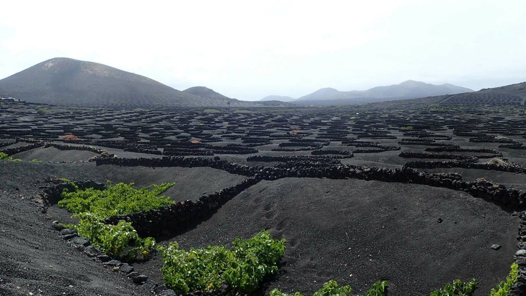
Lanzarote cultivated field
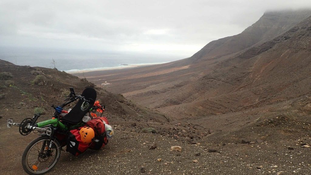
The bike is not very loaded but the month of inactivity and the wind do not really help during these two days. I will manage to reach the north of the island, as far as Orzola, and then cross Lanzarote to return to the boat. The road is quiet and the scenery is always beautiful.
On the fourth day in the archipelago, I left Lanzarote and Thierry for Fuerteventura. The twenty kilometers from playa Blanca to Corralejo, will be achieved by ferry. Arriving in the early afternoon, I have time to have lunch, pedal less than 30km and end the day with a short hike in Valleebron.
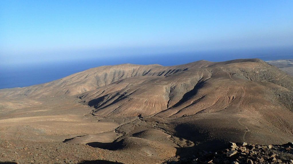
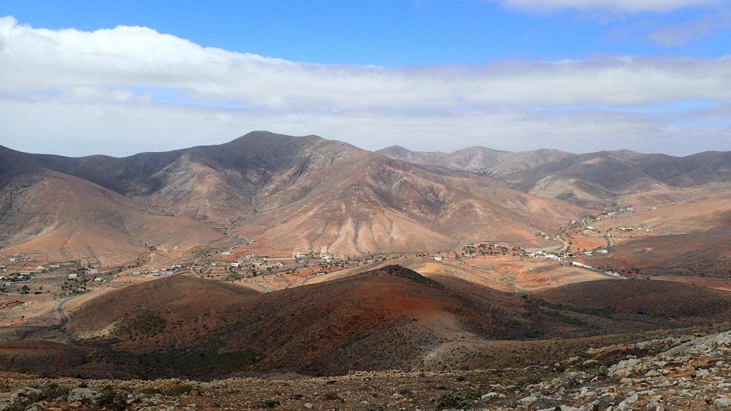
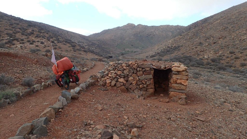
On the program of the second day, the crossing of the Mountains of Betancouria with two hikes. One above Betancouria, and the other hike over Toto, a small village. The wind is still blowing, but in my back this time. On the other hand, it is very strong in “altitude” (the top of the island, pico de la Zarza, peaks at only 807m). A little stone shelter will be my home that night.
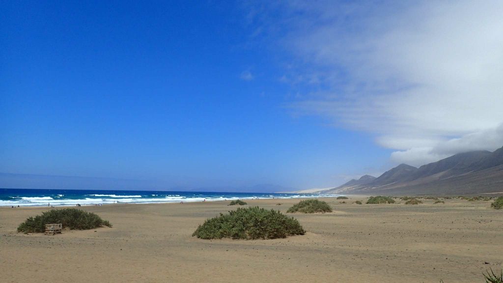
On the third day in Fuerteventura, my path goes through a beautiful valley descending on Pared, and the Mount Cardon watches. Then, I cross the isthmus following the dunes. After these two days alone in the nature, my lunch in a seaside resort is a bit brutal (but the shower will be nice!). The people here speak to me directly in German…
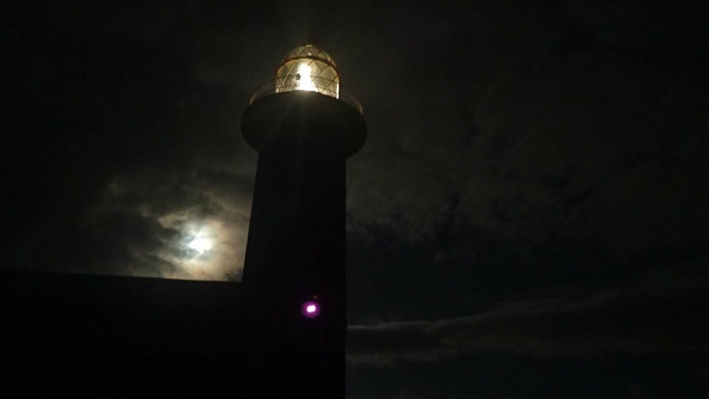
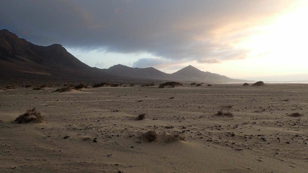
The road between Morro Jable and Puerto de la Cruz is a 4-star track: well rolling with few pebbles. Mountains to my right and the sea on the left as only companions. At the lighthouse in Punta Janda, a German-Italian family invites me to share their dinner. They live in Munich and have rented a campervan to visit the island. Tonight, I’ll sleep under the stars, to the sound of wind and waves. Clouds pass by and cause full moon clearing. I woke up in the middle of the night and can’t close my eyes anymore. 2 hours to contemplate the two lighthouses: one ephemeral natural, the other artificial but perpetual.
End of the island
In the morning, the drizzle does not make you want to linger here. It was a short night, but a beautiful beach awaits me for a nap: in Cofete. Few kilometers and some vertical meters separate us! A winding road takes me there. This beach stretches for several kilometers. At the only café in the village, I chat with an Englishman who has hiked from the other side, he confirms to me that it would be difficult to ride a bike but that once the pass behind the descent would be simpler. I like this option because it would allow me to try the ascent of the top of the island: the pico de la Zarza. And then join Morro Jable to take the ferry.
Another night under the stars, and always wind. My day starts early because I know the ascent will be long and difficult. I plan to climb up to the pass and then leave the bike and walk up to Zarza. There is no trail on the map but it seems doable. The climb to the pass is as difficult as expected! I should go back and forth several times, with the bags first and then with the bike. But I won’t run into anyone! After three hours of climbing, I finally reach the pass. Bike laid, I begin the ascent on foot. I have to make my way “logically” through a mineral maze. After a good hour and a half, I almost reach the top and there, surprise: a big fence awaits me … I have the choice to continue at the ISO 1 following the fence and then climb but I may run out of time … so I prefer to have lunch and turn back. Finally, the descent, supposedly easy, is actually not that ideal … It is even more complicated than the climb because of many high “steps”. So the bags touch them and I risk damaging them. In short, a shitty day, which ends with 6 hours of ferry!
Fighter’s journey
Tenerife, the island of a thousand faces
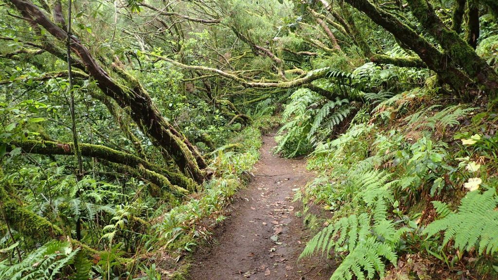
The ferry dropped me at Santa Cruz de Tenerife and the nearest campsite is in Tejina, north of here. I don’t really have prepared anything, but I plan to stay on this island for at least ten days. After a short stint at the marina, I head north. The climb to La Laguna is rather long and steep; In addition, the heavy traffic and the impatience of motorists do not add any pleasure to the ascent of this urban mountain. I found peace and quiet once at the campsite. Apart from a French summer camp, there are not many people. The Anaga Nature Park is not far from here and looks perfect for a bike-hike combo! On the other hand, it is strictly forbidden to camp in this area… A Spanish hiker will make me understand that the bivouac seems tolerated. If not, the only options to sleep up there are in hostel or guesthouse – both options not fitting my budget!
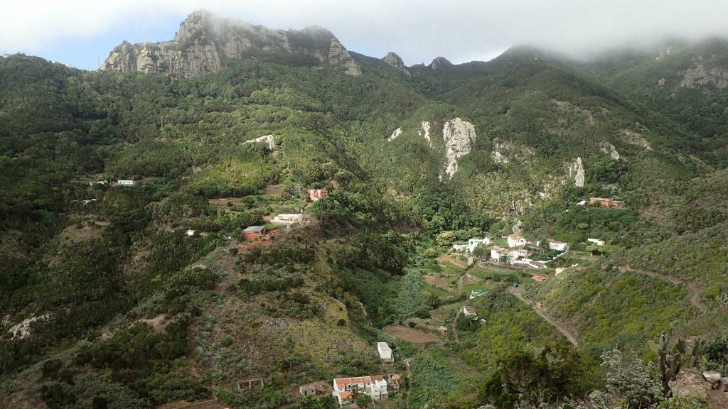
Anaga Parque
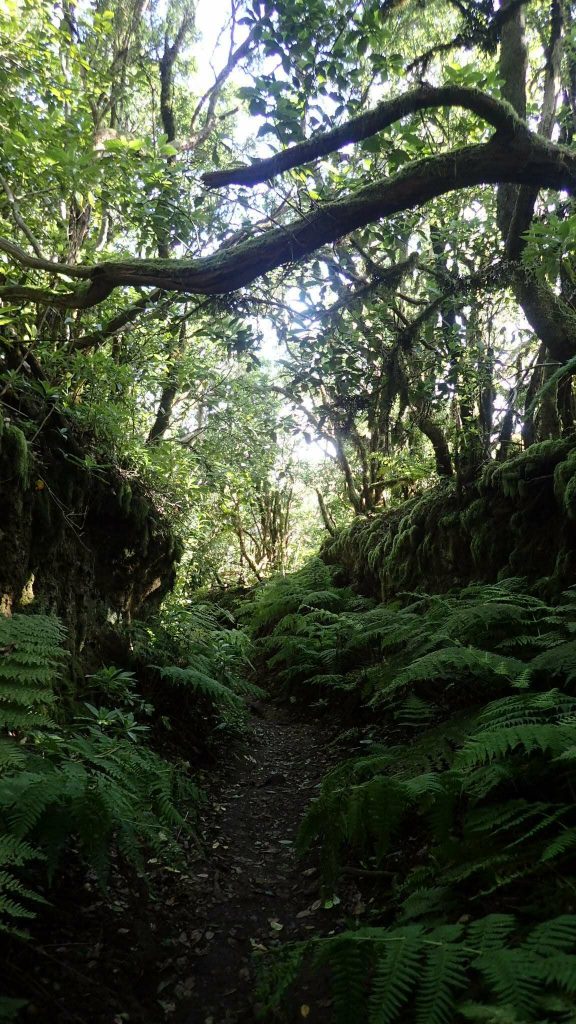
The next day, I left for the Anaga with two bags, the rest will be waiting for me at the campsite. First stop: Cruz del Carmen. Once the bike locked in front of a café, I walk to Las Carboneras. Then come back through Tavorno to pico Ingles. A very green and humid forest but also steep ridges reminding the Alps. First night in the forest, it’s a little cold, but I manage to sleep a little over 6 hours.
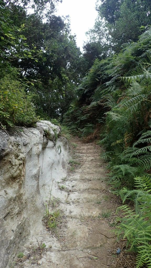
Natural stairs
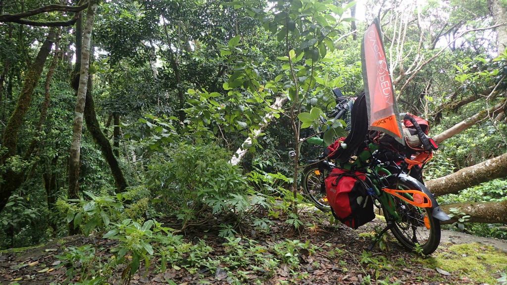
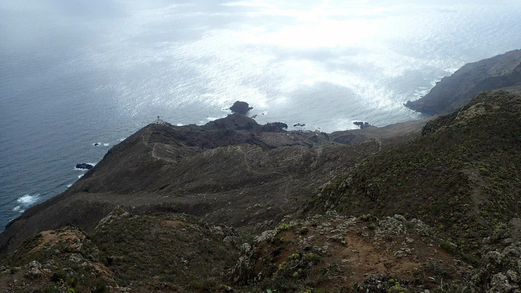
As there is no coffee in the area, it is in the forest that I will hide the bike. The camp (pictured above: Red and green) is the ideal hideout. Then I head to the village of Chamorga. It’s the same rainforest as the day before, wrapped in morning fog. I will make a small loop to the hamlet of Roque Bermejo. The Tafada Mountains and the Anaga Lighthouse are on my way to go. The return will be in the canyon leading to Chamorga. Very nice valley. To get back to the camp, I can wait for the bus or hitchhike, the second option seems more interesting! Barely a thumbs up, a driver stops. He is originally from Barcelona but works here. Since his last trip to France, he has been trying to learn French.
Bike found, I go back to Roque Negro. In the car, the Catalan recommended a restaurant that serves local cuisine: casa Santiago. Perfect timing, I passed close by around 13:30: Hispanic lunch time. Music escapes from the entrance. A guitarist, a singer and two fans are seated on my left. In front of me, an old man reads his diary. And two locals are at the counter with small glasses of red wine. Good atmosphere! I sit on the terrace and order half a goat’s racion with papas (potatoes), and a small glass of tinto (red wine). To taste. It’s pretty good and not very expensive.
With a full stomach, I begin the descent towards Roque Negro. The hamlet is not very big, the village main square is all cute. Not to mention the stunning views of the village of Afur. The area is quiet anyway. It is not 3pm when I arrive, so I lock the bike and walk around. Back, the square has become more lively than before! In a small neighboring room to the church, singing classes are given. An hour later, a dance rehearsal takes place on the forecourt of the church. I chose the place and the time! At the end of the rehearsal, I go to the village’s doyenne to ask if I can sleep in the square. Just one night. It’ll be cooler than the day before. Probably because of the clear skies. But hey, I will survive: now is the 7th night I spend without a tent!
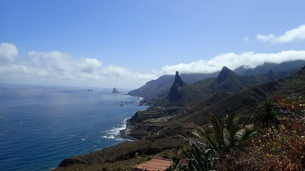
For my last day in the Anaga, I offer myself a beautiful walk: from Roque Negro to Taganana, town of the nearby valley, and back to Afur. Several landscapes on the menu: first the green forest, then a coastal path mixing desert, Brittany and Norwegian fjords. I will first meet two friends, a Brazilian and a Venezuelan. Anibal, the Venezuelan, explains to me that during the Franco era, times were hard for the Canaries and many emigrated to Venezuela. Today, the opposite happens. Venezuela is also nicknamed the eighth island by locals.
A French couple catches up with us, I decide to continue with them because they flit here and there a little less, and my conversation in Spanish starts to go in circles … they are Toulouse and take advantage of the company committee to offer themselves an all-inclusive week on Tenerife. Adept of hitchhiking, they share their failures on the island from Puerto de la Cruz (major northern city). We will walk together to Afur discussing our travels, our hikes, etc. It feels good to meet people by chance! These trails are not much traveled whereas they are beautiful! For this I thank the car for existing: it allows to contain tourists near the car parks. To close this stay in the park, 300m of climb await me followed by a long descent. Besides, I’m getting to know the road!
Back at the campsite, I’ll have a good chat with an Italian. He too travels by bike… for four years now! He has lived here for 2 years and works in exchange for a “presidential” tent and surely some dineros. He’s thinking of opening his own campsite here, which, in my opinion, would really be useful considering the little offer there is! On the other hand, a cyclotourist offer does not seem viable as there are few cyclists … perhaps the electric bike could help the development of cycling tourism in these hilly areas?
Acampada at Teide
After the Anaga, I started a retreat in the main park of the island. First in the zona de acampada de la Caldera, then in Las Raices. These are kinds of public camping that must be booked online, the number of plots and duration are limited (up to seven consecutive days). There is usually water (not drinkable, but I filter.. sometimes) and toilets. I think some areas have showers… no guard nor fences, though. But I always left the bike locked during my daily excursions, without worries! There is not much passage in these areas…
On a bike, which says mountain, says “heat your thighs” and watch out for buses! Departure at 10am and arrival at 5pm, for 50km and 1500m climb… The last straight is winding, with buses passing at full speed. On one hand, I wish public transport would be more developed in the city, on the other hand I find it dangerous in the mountains … That said, the roads are not very suitable for the few cyclists (and the critical mass2 may never be reached).
To explore the surrounding area, I will walk around on the first day. Several hikes start from the camp. I’m taking the paraglider with me to pratice ground handling at the takeoff of Isaña. Three-quarters of the hike is in the pines, and it goes straight up the slope. Reaching the plateau, the landscape changes directly from the dense forest to the desert! Lizards and many spiders are the only inhabitants here! All spider nets confirm to me that this trail is not very taken … The summit is far from the dreamt terrain to practice ground handling: abrasive volcanic rocks and steep slope. In addition, the majority blow comes more from the wind than from the breeze. It’s not ideal for what I wanted to do, but I still unfold my sail. Three gusts make me quickly change my mind, plus the wind has forced, so the game is over for today. A little disappointed, I started returning to the campsite, hitchhiking this time. Once again, I got lucky: a Venezuelan woman stops. My paragliding bag caught her eye, and for good reason she’s working with a pilot flying here. While driving, she tells me that the official take-off is actually a little further and offers to take me there to fly. But I decline, I find the wind too strong. They have a tandem flight scheduled the next morning and she can bring me with them. It will be for a “plouf” 3 but why not!
Flying is good, with a landing is better
Thanks to Erica I met the previous day, I will be able to make my first flight since Arbas! The car is almost full with: Marco the pilot, Erica and their client in search of adrenaline. Today, the conditions are perfect: for once the cloudy veil under the plateau has dissipated. Marco explained to me that in the Canary Islands some paragliding rules do not really apply… It is therefore tolerated to take off from a national park without visibility on landing! Landing that in our case will be on a beach in Puerto de la Cruz.
On take-off we find other “touristicommercial” two-seaters (tandem paraglider), the breeze is still light. Marco will take off before me so that I can follow him to the landing. To fly, it is better to feel good physically and morally, but also to have a good feeling about the flight, the conditions, etc. This is my case this Sunday: I am rested, a little excited and the conditions are calm. During a flight, the critical phases are mainly take-off and landing. For my part, I master the first but the second still has a significant margin of improvement! The landing requires a good knowledge of its wing and its glide ratio, which makes it possible to make a beautiful “final”: the last straight glide before the landing. The larger the landing site (the one in Lumbin, under Saint Hilaire du Touvet is in the “highway” category), the easier it is to land. A good practice when discovering a new site is to visit the landing before taking off: this allows to visualize the approaches 4“calmly” from the ground. But I did not do it today for several reasons: premio the landing is quite far from the campsite (in distance AND vertical), deuxio it is a beach so I imagine it large and not too busy (given the number of tandems that land).
The sail is unfolded under the sun of 10:30, Marco is unraveling his lines, I imitate him. At first, I didn’t like this phase so much because many knots appear magically and they are “often” difficult to undo. But with time, you learn to fold your sail better, so knots become rarer. In addition, the flight begins as soon as the sail comes out of its cover, mentally the concentration is 100% on our lines, the harness, the evolution of the wind, the helmet … In short, the preparation of paragliding is done in a kind of mental bubble, almost meditative. Marco has a few knots, so I take the opportunity to adjust the gopro: angle of view, image quality, are important if I want to be able to fly you with me later!
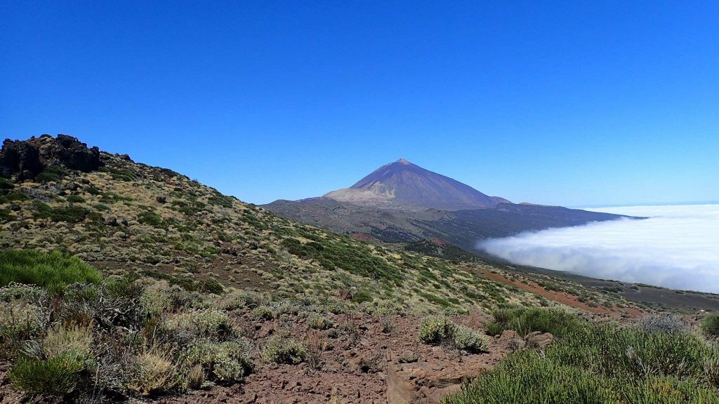
The two-seater’s gone. It’s my turn now. The breeze, always light, should still allow me to do a reverse launch 5. The look down the slope, on the windsock, waiting for a new air cycle. It happens, my sail goes up gently, very light, the line cone shows no defect: here we go! I hardly feel it above my head because the air stream is weak, some speed will help her. A few strides, and I fly away. I’m so happy. On the left the Teide overlooks me from the top of its 3700m and in front of me, the vast blue Atlantic mesmerizes me. In the background appears La Palma, a hundred kilometers away. The thermals are not yet established. So I continue my descent slowly towards Puerto de la Cruz, flying first over Teide’s pine crown and then over the coastal urban area.
At sea level, I finally see the landing. A small bay in the heart of the city. The area of loss of altitude is located above a cliff upstream. The streetlights and the large buildings make the beach less attractive to any paragliding beginner… Although the beach is rather large, the “unofficial” landing zone is much smaller (15m long and 5m wide). After several round trips along the cliff, I decided to go to the final. A little late, I realized I’m still too high. The sail is still about 30-35 km/h but the buildings seem to get closer! I have to brake it and zigzag between the streetlights. There are many pedestrians, but I do not yet consider them as obstacles. This last S with the braked sail allows me to lose the missing altitude, but it is not very clean and a little dangerous for pedestrians below or myself … Finally, the sand comes closer, hands up to enter well in the gradient, then I brake the sail completely right before impact. Pfiooouuu. What a sh*tt@ landing!
I point out to Marco that it’s rather difficult as an approach, he replies “it’s true, the official landing is on the parking lot behind but on the beach it’s more impressive for tourists and it’s a good advertisement for us!” In short, a new lesson learned today: seeing the landing of a new site is NECESSARY still at my level. The second lesson is to be wary of what local pilots say, especially if they are not working for a paragliding school (or ask several). This kind of error is beneficial in the discipline of paragliding because it allows to set the record straight. It’s barely thirteen o’clock when I reach the campsite but I consider my day over.
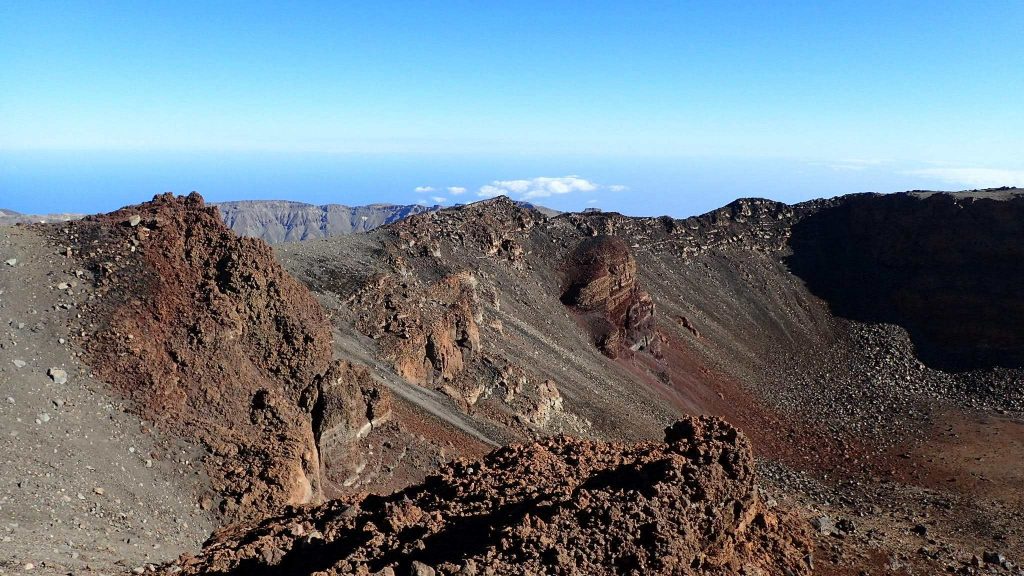
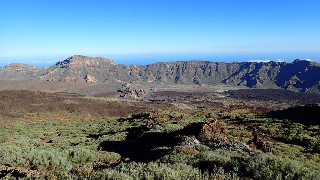
Rando at Pico
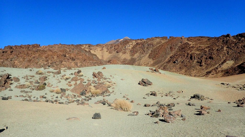
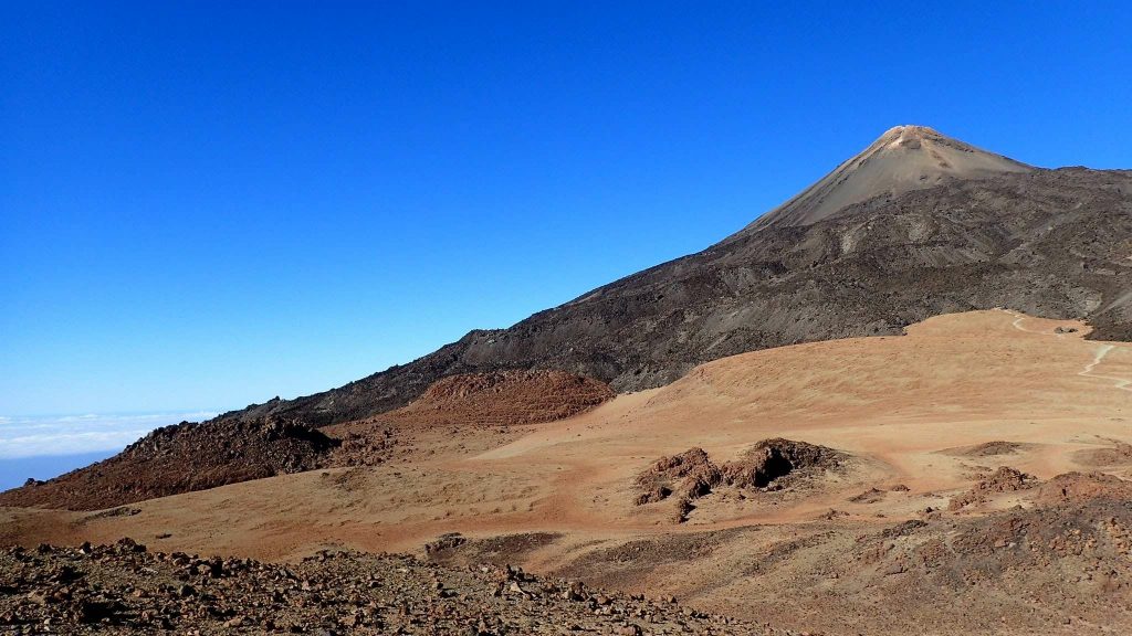
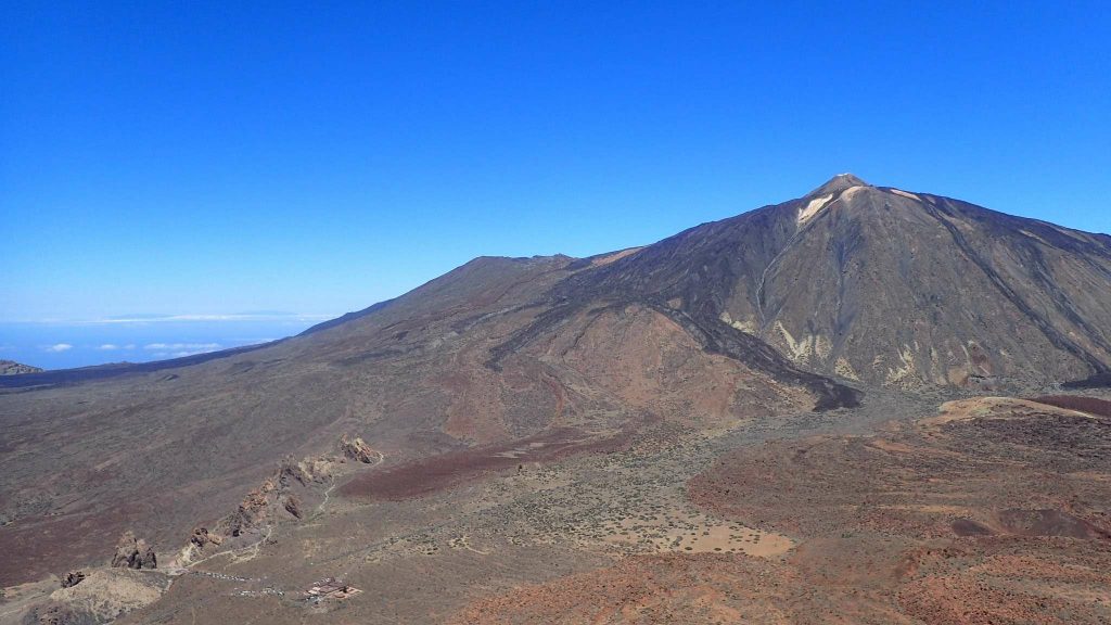
Pico del Teide is the roof of Spain. At the beginning of the year, with some friends, we had climbed on skis the peak of Aneto (Pyrenees) in a completely different setting. But the latter is only the highest peak in metropolitan Spain! The Teide volcano is 314m taller. Access to the summit is restricted for conservation, so you have to apply for a permiso to access it. Two to four months early. Of course, I don’t have it… The program of the day is to hike until the restricted area and negotiate once up there. In any case, the hike promises to be scenic!
Three minutes with the thumb up in the air allow me to go up to the trail of Montaña Blanca by hitchhiking. The air is already warm at 9:30 a.m. Some groups are descending, perhaps they went up early in the morning (no permit required in this case). I walk pretty fast, it’s my sport of the day. The Altavista refugio behind me, I meet a Spanish hiker, curious, I ask him if it is possible to climb the pico from the east face. He, too, walked up. He also did not have the permit. He too thinks that the mountain is not a tourist attraction but an area of freedom and responsibility. The Spanish word he uses to describe the person in charge of the entrance seems anything but kind! It’s going to be harder than I expected…
The limit altitude is 3550m, at the arrival of the cable car. The contrast is striking: you have to make your way between the tourists while I counted 9 people on the ascent path. I understood after that the tourists actually spend a day (max. two) in the park. So they have time to go up to the Teide (thanks to the cable car), visit the Roques de Garcia, take pictures from several viewpoints (thanks to the car). But hey, that’s not really an excuse!
Negotiations then began with Mr. Permiso-necesario. Long, difficult, useless (?), I finally understand that it would be possible to climb once the cable car closes, around 7pm, then the Permiso-necesario team would be leaving the entrance. It’s 12:30. I decide to wait until then, I will read in the meantime. Many people are not aware of the permit. Others have “outdated” permits. Some want to change the permit holder. But Mr. Permiso-necesario is formal: the piece of paper is strictly nominative and valid only on the indicated date. On one hand, I understand and even support conservation efforts, but I find it hard to believe that the 200 authorized people a day are coming on D-Day. Even in Germany, where mountain huts are all booked weeks in advance, there were always last-minute withdrawals for the poor late French and Spanish… Around 5 p.m. Mr. Permiso-necesario leaves his post, he does not fail to inform his colleague of the cable car that will take over. A couple of Spaniards arrive at the top, sweaty. They have no permit either. They argue a little with the new guardian who has a slightly different speech: “If you go up without a permit, even outside the opening hours, you risk a fine of 6,000 euros”. Perplex, the couple does not believe it but facing the stubbornness of the boy they give up their tonight ascent. I’ll stay an hour longer to think, then I’ll also decide to go home, the altitude and the sun having taken my mind away. Here is the second “forbidden” mountain of the trip (or third counting Mount Zarza)…
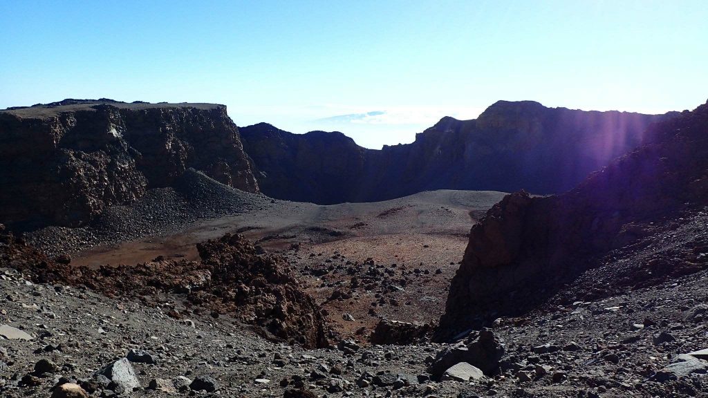
For the descent, I will take another path, via the pico Viejo (the old peak), superb crater. In addition, the view of the Teide is exceptional! The German couple I meet on the way will drop me off at the campsite to end this long day.
End of stay on Tenerife
My booking at the Caldera ends this Tuesday, so I’m going to Las Raices, which is closer to Santa Cruz, but also further from the national park. After several times riding up this road (by car…), I have to climb it by the force of the calves!
I fell in love with the Teide park, and regret my new campsite… Now 40 to 50km separates me from the beautiful hikes. This does not stop me and I will be able to make two more hikes thanks to hitchhiking!
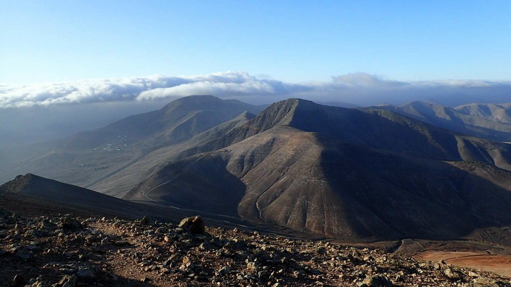
The second was maravillosa (wonderful): the Siete Cañadas (seven ravines/canyons), with the Summit Guajara. This Thursday was an “optimized” day! The total hitchhiking waiting time was 30 minutes max, for 1 hour and a half of travel and 5 different cars: which is pretty good. Like all the other hikes so far, I will meet tourists in areas 2km from a car park only! So I have the trail for myself during 14km. The landscapes change along the way, but keep the Teide as a sentinel.
After the hike, I want to take the ferry to Gran Canaria. Hitchhiking is working so well, I will be able to board with the 6.30pm ferry, buying my ticket 2 minutes before at the ticket counter! Adios Tenerife!
Hitchhiking in Tenerife
Hitchhiking is an ecological practice open to all, preferably to whom without time constraint. I think it’s a good transition from an all-car society to “all public transport”. Based on trust and solidarity, this mode of travel allows us to reconnect with reality through exchanges that are unfortunately no longer possible today (social, political mix, etc.). For example, I was able, thanks to hitchhiking, to exchange with workers, Islamists, Corsicans a little dangerous, craftsmen and others.
In total, 13 cars helped me making 8 one-way trips. Statistically, the cars were made up of 38.5% single man, 38.5% couple and 23% female (single, family, friend). About half and half for the local VS tourist distribution. Of the tourists, 70% were German-speaking (Swiss, German, Austrian)! And the price of the best car goes to ..
A 100%-girls car: an Austrian mother and her two daughters on holiday. The eldest is studying here, so the family took the opportunity to visit her! I have the impression that tourists hope to help a local when they stop… in fact, not at all! To thank them, I will help them finish their pizza, which was huge.
Footnotes
- Same altitude
- Critical mass is the minimum number of cyclists needed for motorists to pay more attention to them
- For the vocabulary of paragliding, see this article
- Trajectories before landing, which generally avoids physical obstacles (high voltage line, road, …) and aerological traps
- Paragliding takeoff with the sail in front of the pilot